
Filter by
The language used throughout the course, in both instruction and assessments.
Results for "remote+sensing"

University of Toronto
Skills you'll gain: ArcGIS, GIS Software, Spatial Data Analysis, Geographic Information Systems, Geospatial Information and Technology, Geospatial Mapping, Data Mapping, Data Collection
 Status: Free
École Polytechnique Fédérale de Lausanne
Skills you'll gain: Geographic Information Systems, Data Modeling, GIS Software, SQL, Database Design, Spatial Data Analysis, Spatial Analysis, Relational Databases, Land Management, Data Capture, Data Storage, Data Management

MathWorks
Skills you'll gain: Image Analysis, Computer Vision, Matlab, Anomaly Detection, Geospatial Information and Technology, Applied Machine Learning, Data Transformation, Algorithms

University of Colorado Boulder
Skills you'll gain: Embedded Systems, Electronic Hardware, Embedded Software, Hardware Design, Electronic Components, Electrical Engineering, Thermal Management, Display Devices, Debugging, Schematic Diagrams, Development Environment

Coursera Project Network
Skills you'll gain: Microsoft Azure, Internet Of Things, Real Time Data, Cloud Storage, Data Storage Technologies, Query Languages, Peripheral Devices
 Status: Free
University of California San Diego
Skills you'll gain: Pollution Prevention, Environmental Policy, Environment and Resource Management, Natural Resource Management, Environment, Socioeconomics, Social Sciences, Public Policies, Civil Engineering, Economics, Life Sciences

MathWorks
Skills you'll gain: Image Analysis, Matlab, Computer Vision, Spatial Data Analysis, Quantitative Research, Data Import/Export, Algorithms, Data Structures

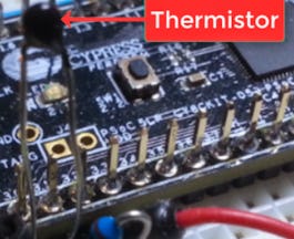
University of Colorado Boulder
Skills you'll gain: Equipment Design, System Requirements, Engineering Calculations, Hardware Design, Simulation and Simulation Software, Computer-Aided Design, Engineering Design Process, Mathematical Modeling, Applied Mathematics

Skills you'll gain: Image Analysis, Matlab, Computer Vision, Automation, Anomaly Detection, Spatial Data Analysis, Engineering Calculations, Spatial Analysis, 3D Modeling, Quantitative Research, Visualization (Computer Graphics), Data Analysis Software, Data Import/Export, Algorithms, Data Structures, Data Store
 Status: Free
Universidad Nacional Autónoma de México
Skills you'll gain: Mitigation, Risk Control, Vulnerability, Emergency Response, Environment and Resource Management, Water Resources, Research, Physical Science, Environmental Monitoring, Geospatial Information and Technology


Duke University
Skills you'll gain: Environmental Monitoring, Data Ethics, Environment, Environmental Issue, Geospatial Information and Technology, Ethical Standards And Conduct, Research, Science and Research, Data Collection, Safety and Security
 Status: Free
École Polytechnique
Skills you'll gain: Environmental Issue, Water Resources, Time Series Analysis and Forecasting, Environment and Resource Management, Environmental Monitoring, Predictive Modeling, Estimation, Probability Distribution, Mathematical Modeling, Physical Science
In summary, here are 10 of our most popular remote+sensing courses
- Introduction to GIS Mapping: University of Toronto
- Systèmes d’Information Géographique - Partie 1: École Polytechnique Fédérale de Lausanne
- Introduction to Computer Vision: MathWorks
- Sensors and Sensor Circuit Design: University of Colorado Boulder
- Processing IoT Hub data streams with Azure Stream Analytics: Coursera Project Network
- Our Energy Future: University of California San Diego
- Introduction to Image Processing: MathWorks
- Optical Efficiency and Resolution: University of Colorado Boulder
- Image Processing for Engineering and Science: MathWorks
- Evaluación de peligros y riesgos por fenómenos naturales: Universidad Nacional Autónoma de México


