Filter by
The language used throughout the course, in both instruction and assessments.
Explore the Cartography Course Catalog


Michigan State University
Skills you'll gain: Infographics, Adobe Illustrator, Graphic and Visual Design, Data Mapping, Typography, Design Elements And Principles, Graphical Tools, Color Theory

Coursera Project Network
Skills you'll gain: Tensorflow, Keras (Neural Network Library), Test Data, Image Analysis, Computer Vision, Artificial Neural Networks, Deep Learning
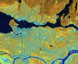

University of Toronto
Skills you'll gain: Geographic Information Systems, GIS Software, Spatial Analysis, Spatial Data Analysis, Geospatial Mapping, Query Languages, Data Processing, Data Manipulation, Image Analysis
 Status: Free
Politecnico di Milano
Skills you'll gain: Civil and Architectural Engineering, Social Studies, Architecture and Construction, Anthropology, Physical Science, Cultural Responsiveness, Social Sciences, Timelines, General Science and Research, Political Sciences, Systems Of Measurement, Environment


Duke University
Skills you'll gain: Spatial Analysis, Human Learning, Image Analysis, Experimentation, Scientific Methods, Physics, Research


Columbia University
Skills you'll gain: Image Analysis, Computer Vision, Color Theory, Computer Graphics, Data Capture, Data Cleansing, Data Processing, Data Transformation, Computational Thinking, Histogram, Sampling (Statistics), Algorithms, Applied Mathematics


California Institute of the Arts
Skills you'll gain: Graphic and Visual Design, Typography, Graphic Design, Visual Design, Design Elements And Principles, Creative Design, Digital Design, Creativity, Computer Graphic Techniques, Color Theory, Adobe Photoshop, Aesthetics

Skills you'll gain: SAS (Software), Forecasting, Spatial Data Analysis, Data Visualization Software, Time Series Analysis and Forecasting, Data-Driven Decision-Making, Predictive Analytics, Geospatial Mapping, Data Analysis, Geographic Information Systems, Data Manipulation, Statistical Programming
 Status: Free
École Polytechnique Fédérale de Lausanne
Skills you'll gain: GIS Software, Spatial Analysis, Geographic Information Systems, Spatial Data Analysis, Geospatial Mapping, Augmented Reality, Sampling (Statistics), Data Mapping, Correlation Analysis, Color Theory

Coursera Project Network
Skills you'll gain: Time Series Analysis and Forecasting, Data Visualization Software, Statistical Visualization, Plot (Graphics), Box Plots, Anomaly Detection, Heat Maps, Data Analysis, Spatial Data Analysis, Exploratory Data Analysis, Data Processing


Yonsei University
Skills you'll gain: Spatial Data Analysis, Spatial Analysis, Geographic Information Systems, Geospatial Mapping, Database Management Systems, Big Data, Apache Hadoop, Data Modeling, PostgreSQL, Network Analysis


Macquarie University
Skills you'll gain: Pivot Tables And Charts, Data Storytelling, Data Presentation, Data Visualization Software, Data Visualization, Interactive Data Visualization, Spreadsheet Software, Dashboard, Microsoft Excel, Excel Macros, Infographics, Excel Formulas, Data Analysis, Data Manipulation, Forecasting
In summary, here are 10 of our most popular cartography courses
- Design and Make Infographics (Project-Centered Course): Michigan State University
- Object Localization with TensorFlow: Coursera Project Network
- Spatial Analysis and Satellite Imagery in a GIS: University of Toronto
- Archaeoastronomy: Politecnico di Milano
- The Brain and Space: Duke University
- Camera and Imaging: Columbia University
- Fundamentos del Diseño Gráfico: California Institute of the Arts
- Using Data for Geographic Mapping and Forecasting in SAS Visual Analytics: SAS
- Systèmes d’Information Géographique - Partie 2: École Polytechnique Fédérale de Lausanne
- Time Series Data Visualization And Analysis Techniques : Coursera Project Network


