
Filter by
The language used throughout the course, in both instruction and assessments.
Results for "esri"


L&T EduTech
Skills you'll gain: Geospatial Information and Technology, Spatial Analysis, GIS Software, Spatial Data Analysis, Geographic Information Systems, Geospatial Mapping, Database Management, Database Management Systems, Construction Management, ArcGIS, Relational Databases, Visualization (Computer Graphics), Heat Maps, Civil and Architectural Engineering, Global Positioning Systems, Decision Support Systems, Building Information Modeling, As-Built Drawings, Survey Creation, AutoCAD Civil 3D

L&T EduTech
Skills you'll gain: Environment and Resource Management, Natural Resource Management, Geostatistics, Production Process, Engineering Practices, Process Engineering, Emerging Technologies, Safety and Security, Geospatial Information and Technology, Engineering, Mathematical Modeling

UNSW Sydney (The University of New South Wales)
Skills you'll gain: Image Analysis, Unsupervised Learning, Geospatial Information and Technology, Computer Vision, Feature Engineering, Spatial Analysis, Machine Learning, Dimensionality Reduction, Linear Algebra, Deep Learning, Supervised Learning, Statistical Methods, Data Cleansing, Artificial Neural Networks

University of Toronto
Skills you'll gain: Geographic Information Systems, GIS Software, Spatial Analysis, Spatial Data Analysis, Geospatial Mapping, Query Languages, Data Processing, Data Manipulation, Image Analysis


University of Michigan
Skills you'll gain: Augmented and Virtual Reality (AR/VR), Storyboarding, Augmented Reality, Virtual Reality, Usability Testing, Design Thinking, User Experience, Prototyping, Interaction Design, Conceptual Design, User Centered Design, Usability, Human Centered Design, Wireframing, Ideation

Skills you'll gain: Safety Assurance, Accident Prevention, Environment and Resource Management, Environment, Electrical Safety, Environmental Issue, Plant Operations and Management, Waste Minimization, Fire And Life Safety, Risk Analysis, Natural Resource Management, Failure Mode And Effects Analysis, Pollution Prevention, Water Resources, Process Control, Process Engineering, Breakage Control


Yonsei University
Skills you'll gain: Spatial Data Analysis, Spatial Analysis, Geographic Information Systems, Geospatial Mapping, Database Management Systems, Big Data, Apache Hadoop, Data Modeling, PostgreSQL, Network Analysis
 Status: Free
Kennesaw State University
Skills you'll gain: Generative AI, Data Ethics, ChatGPT, Education and Training, Technical Communication, Artificial Intelligence, Ethical Standards And Conduct, Scalability


Coursera Project Network
Skills you'll gain: Marketing Design, Social Media Marketing, Social Media Content, Marketing Materials, Marketing, Social Media, Loyalty Programs, Advertising, Creative Design, Brand Loyalty, Customer Engagement

L&T EduTech
Skills you'll gain: Spatial Analysis, GIS Software, Spatial Data Analysis, Geospatial Mapping, Geographic Information Systems, Heat Maps, Building Information Modeling, Global Positioning Systems, Network Analysis, Image Analysis, Data Import/Export, Unsupervised Learning, Software Installation, Supervised Learning, User Interface (UI)

Skills you'll gain: Spatial Data Analysis, Spatial Analysis, Geographic Information Systems, Geospatial Information and Technology, Data Analysis, Big Data, Data Visualization, Analytics, Exploratory Data Analysis, Google Cloud Platform, Cloud Management, Data Access, Query Languages
 Status: Free
École Polytechnique Fédérale de Lausanne
Skills you'll gain: GIS Software, Spatial Analysis, Geographic Information Systems, Spatial Data Analysis, Geospatial Mapping, Augmented Reality, Sampling (Statistics), Data Mapping, Correlation Analysis, Color Theory
Searches related to esri
In summary, here are 10 of our most popular esri courses
- Geospatial Techniques for Engineers: L&T EduTech
- Hydrocarbon Exploration and Production: L&T EduTech
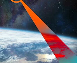
- Remote Sensing Image Acquisition, Analysis and Applications: UNSW Sydney (The University of New South Wales)
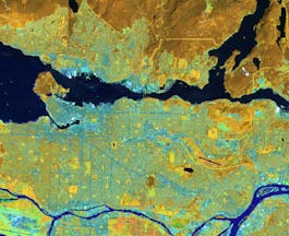
- Spatial Analysis and Satellite Imagery in a GIS: University of Toronto
- User Experience & Interaction Design for AR/VR/MR/XR: University of Michigan
- Utilities, Safety & Environmental Care in Oil & Gas Industry: L&T EduTech
- Spatial Data Science and Applications: Yonsei University
- AI for Education (Intermediate): Kennesaw State University
- Marketing Design with Easil: Coursera Project Network
- Mastering Geospatial Analysis with QGIS: L&T EduTech


