
Filter by
The language used throughout the course, in both instruction and assessments.
Results for "geographic+information+system+(gis)"
 Status: Free
École normale supérieure
Skills you'll gain: Data Visualization, Statistical Visualization, Geospatial Mapping, Data Mapping, Geographic Information Systems, Graphic Design, Data Presentation, Graphics Software, Quantitative Research, Color Theory

Johns Hopkins University
Skills you'll gain: Epidemiology, Geographic Information Systems, Data Visualization Software, GIS Software, Biostatistics, Geospatial Mapping, Infectious Diseases, Health Assessment, Graphing, Risk Analysis, Data Collection


L&T EduTech
Skills you'll gain: Geospatial Mapping, Geospatial Information and Technology, Geographic Information Systems, Spatial Data Analysis, Construction Management, Visualization (Computer Graphics), Civil and Architectural Engineering, Spatial Analysis, Global Positioning Systems, As-Built Drawings, Survey Creation, AutoCAD Civil 3D, Environmental Monitoring, Systems Of Measurement, 3D Modeling, Data Cleansing
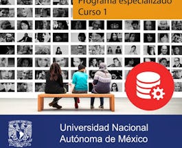

Universidad Nacional Autónoma de México
Skills you'll gain: Database Systems, Relational Databases, Database Management, SQL, Database Design, Information Systems, MySQL, NoSQL, Data Modeling, Transaction Processing, MySQL Workbench, Information Systems Security, Performance Tuning, Data Manipulation, Conceptual Design

Skills you'll gain: SAS (Software), Forecasting, Spatial Data Analysis, Data Visualization Software, Time Series Analysis and Forecasting, Data-Driven Decision-Making, Predictive Analytics, Geospatial Mapping, Data Analysis, Geographic Information Systems, Data Manipulation, Statistical Programming


Howard University
Skills you'll gain: Design Thinking, Business Software, Information Systems, Cloud Computing, Business Systems, Solution Design, Business Technologies, Cloud Computing Architecture, Customer Analysis, Cloud Security, Virtualization, Cloud Platforms, Digital Transformation, Cloud Services, Management Information Systems, Product Design, Business Solutions, Information Technology, Process Design, Cloud Infrastructure


École Polytechnique Fédérale de Lausanne
Skills you'll gain: Spatial Analysis, Spatial Data Analysis, GIS Software, Geographic Information Systems, Geospatial Mapping, Geostatistics, Interactive Data Visualization, Data Integration, Data Mapping, Statistical Analysis, Augmented Reality, Sampling (Statistics)


University of California, Irvine
Skills you'll gain: Extract, Transform, Load, Decision Support Systems, Data Warehousing, Data Mining, Database Design, Business Intelligence, Dashboard, Star Schema, Relational Databases, Database Management, Data Visualization Software, Snowflake Schema, Database Systems, Business Reporting, SAS (Software), Data Modeling, Interactive Data Visualization, SQL, Descriptive Statistics, Data Storytelling

Johns Hopkins University
Skills you'll gain: Transportation Operations, Land Management, Growth Strategies, Community Development, Civil Engineering, Geographic Information Systems, Environmental Issue, Policy Analysis, Feasibility Studies, Stakeholder Engagement
 Status: Free
University of Geneva
Skills you'll gain: Geographic Information Systems, Environment and Resource Management, Environmental Monitoring, Natural Resource Management, Spatial Analysis, Environmental Policy, Socioeconomics, Sustainability Reporting, Economics, Stakeholder Engagement
 Status: Free
Sciences Po
Skills you'll gain: Social Sciences, Data Governance, Political Sciences, Governance, Public Administration, Policy Analysis, Big Data, Algorithms, Data Ethics, Computing Platforms, Data-Driven Decision-Making, Information Privacy
 Status: Free
The Pennsylvania State University
Skills you'll gain: Geographic Information Systems, Systems Thinking, Design Thinking, Geospatial Information and Technology, Spatial Analysis, Community Development, Environment, Design, Environment and Resource Management, Decision Support Systems, Creativity, Cultural Responsiveness

Searches related to geographic+information+system+(gis)
In summary, here are 10 of our most popular geographic+information+system+(gis) courses
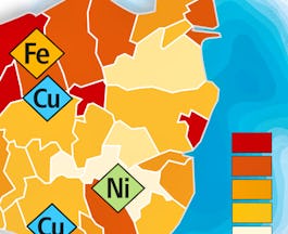
- Cartographie thématique: École normale supérieure
- Essential Epidemiologic Tools for Public Health Practice: Johns Hopkins University
- Geospatial Technology for Construction : L&T EduTech
- Relational database systems: Universidad Nacional Autónoma de México
- Using Data for Geographic Mapping and Forecasting in SAS Visual Analytics: SAS
- Introduction to Information Systems for Business: Howard University
- Geographical Information Systems - Part 2: École Polytechnique Fédérale de Lausanne
- Database Design and Operational Business Intelligence: University of California, Irvine
- Sustainable Regional Principles, Planning and Transportation: Johns Hopkins University
- Ecosystem Services: a Method for Sustainable Development: University of Geneva


