The "Geospatial Information Technology Essentials" course offers a multi-disciplinary approach, integrating key aspects of both Geospatial and Information Technology. Organized into seven comprehensive modules, it provides a thorough learning experience. Module One introduces the fundamentals of Geographic Information Systems (GIS), covering its applications, hardware requirements, data models, and attribute data types. Module Two delves deeper into GIS concepts, focusing on mapping essentials, data conversion techniques, and georeferencing. In Module Three, learners explore GIS database management, including basics of databases, RDBMS, SQL, and advanced geodatabase management. Module Four covers spatial analysis using GIS, with practical demonstrations of techniques like catchment area delineation, overlay analysis, and viewshed analysis. Module Five provides insights into geospatial IT, including enterprise GIS, web and mobile GIS technologies, and practical case studies. In Module Six, system integrations and decision support are discussed, with a focus on command and control center case studies, decision support systems, and open-source GIS projects. Module Seven introduces future trends in geospatial technologies, highlighting advancements in survey and mapping technologies, spatial analytics, and geointelligence. Join us on this journey into Geospatial Information Technology and equip yourself with the essential skills and knowledge to excel in this dynamic field!
Geospatial Information Technology Essentials
Geospatial Information Technology Essentials
Dieser Kurs ist Teil von Spezialisierung für Geospatial Techniques for Engineers
Dozent: Subject Matter Expert
Bei enthalten
11 Bewertungen
Empfohlene Erfahrung
Was Sie lernen werden
Learn GIS basics, data models, practical applications, and hardware requirements, with real-world examples and applications.
Master GIS database management, including RDBMS, SQL, and advanced spatial analysis techniques like overlay and cluster analysis.
Explore web and mobile GIS, system integrations, dashboards, and future trends, with hands-on projects and case studies in geospatial technology .
Kompetenzen, die Sie erwerben
- Kategorie: Decision Support Systems
- Kategorie: Web Applications
- Kategorie: Data Mapping
- Kategorie: GIS Software
- Kategorie: Data Modeling
- Kategorie: Geospatial Information and Technology
- Kategorie: Database Management
- Kategorie: Open Source Technology
- Kategorie: Mobile Development
- Kategorie: Global Positioning Systems
- Kategorie: Geographic Information Systems
- Kategorie: Spatial Analysis
- Der Fähigkeiten-Abschnitt ist eingeklappt. 9 von 12 Fähigkeiten werden angezeigt.
Wichtige Details

Zu Ihrem LinkedIn-Profil hinzufügen
7 Aufgaben
Erfahren Sie, wie Mitarbeiter führender Unternehmen gefragte Kompetenzen erwerben.

Erweitern Sie Ihre Fachkenntnisse
- Lernen Sie neue Konzepte von Branchenexperten
- Gewinnen Sie ein Grundverständnis bestimmter Themen oder Tools
- Erwerben Sie berufsrelevante Kompetenzen durch praktische Projekte
- Erwerben Sie ein Berufszertifikat zur Vorlage

In diesem Kurs gibt es 7 Module
This module introduces the fundamentals of Geographic Information Systems (GIS), covering its basic concepts and applications. Learners will explore GIS in action, the hardware used for GIS implementations, and different GIS data models. The module also includes discussions on digital elevation models (DEM), Triangular Irregular Networks (TIN), attribute data types, and their relevance in GIS applications.
Das ist alles enthalten
8 Videos3 Lektüren1 Aufgabe1 Diskussionsthema
This module focuses on mapping essentials and practical GIS data conversion techniques. Learners will understand the components and types of maps, and gain hands-on experience in converting data from various formats like Excel and CAD to GIS-compatible formats. The module also covers georeferencing techniques for integrating raster data into GIS applications.
Das ist alles enthalten
7 Videos1 Aufgabe1 Diskussionsthema
This module provides a comprehensive overview of GIS database management principles. Learners will explore foundational concepts such as database basics, relational database management systems (RDBMS), and Structured Query Language (SQL) as applied to GIS databases. Advanced topics include the creation and configuration of geodatabases, enterprise geodatabases, and their management in GIS environments.
Das ist alles enthalten
6 Videos1 Aufgabe1 Diskussionsthema
This module explores advanced spatial analysis techniques using Geographic Information Systems (GIS). Learners will delve into methods such as catchment area delineation, overlay analysis, cluster analysis, hotspot analysis, and viewshed analysis. Each technique is demonstrated through practical examples to illustrate their application in spatial data analysis.
Das ist alles enthalten
6 Videos1 Aufgabe1 Diskussionsthema
This module provides an introduction to Geospatial Information Technology (Geospatial IT) and its components. Learners will explore enterprise GIS systems, web GIS technologies including essentials and application overview, mobile GIS technologies along with their technical stack, and various case studies showcasing the practical applications of Geospatial IT in scenarios like emergency response.
Das ist alles enthalten
9 Videos1 Aufgabe1 Diskussionsthema
This module focuses on system integrations and decision support in Geospatial IT. Learners will explore methods for integrating devices into GIS systems, case studies on command & control centers, and the implementation of decision support systems. The module also covers progress and spatial dashboards, highlighting their role in monitoring and reporting spatial data. Additionally, the module introduces open-source GIS technologies and guides learners through creating their own web applications using open-source tools.
Das ist alles enthalten
9 Videos1 Aufgabe1 Diskussionsthema
This module explores the evolving landscape of geospatial technologies and their future trends. Learners will examine the benefits realized from geospatial technologies through case studies, advancements in modern surveying and mapping technologies, and emerging trends in spatial analytics and geo-intelligence. The module concludes by discussing future directions and the potential impact of geospatial technologies on various sectors.
Das ist alles enthalten
9 Videos1 Aufgabe1 Diskussionsthema
Erwerben Sie ein Karrierezertifikat.
Fügen Sie dieses Zeugnis Ihrem LinkedIn-Profil, Lebenslauf oder CV hinzu. Teilen Sie sie in Social Media und in Ihrer Leistungsbeurteilung.
Dozent
von
Mehr von Environmental Science and Sustainability entdecken
 Status: Kostenloser Testzeitraum
L&T EduTech
 Status: Vorschau
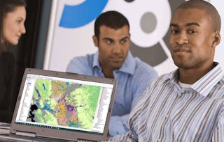 Status: Kostenloser Testzeitraum
University of California, Davis
 Status: Kostenloser Testzeitraum
L&T EduTech
Warum entscheiden sich Menschen für Coursera für ihre Karriere?

Felipe M.

Jennifer J.

Larry W.

Chaitanya A.

Neue Karrieremöglichkeiten mit Coursera Plus
Unbegrenzter Zugang zu 10,000+ Weltklasse-Kursen, praktischen Projekten und berufsqualifizierenden Zertifikatsprogrammen - alles in Ihrem Abonnement enthalten
Bringen Sie Ihre Karriere mit einem Online-Abschluss voran.
Erwerben Sie einen Abschluss von erstklassigen Universitäten – 100 % online
Schließen Sie sich mehr als 3.400 Unternehmen in aller Welt an, die sich für Coursera for Business entschieden haben.
Schulen Sie Ihre Mitarbeiter*innen, um sich in der digitalen Wirtschaft zu behaupten.
Häufig gestellte Fragen
To access the course materials, assignments and to earn a Certificate, you will need to purchase the Certificate experience when you enroll in a course. You can try a Free Trial instead, or apply for Financial Aid. The course may offer 'Full Course, No Certificate' instead. This option lets you see all course materials, submit required assessments, and get a final grade. This also means that you will not be able to purchase a Certificate experience.
When you enroll in the course, you get access to all of the courses in the Specialization, and you earn a certificate when you complete the work. Your electronic Certificate will be added to your Accomplishments page - from there, you can print your Certificate or add it to your LinkedIn profile.
Yes. In select learning programs, you can apply for financial aid or a scholarship if you can’t afford the enrollment fee. If fin aid or scholarship is available for your learning program selection, you’ll find a link to apply on the description page.
Weitere Fragen
Finanzielle Unterstützung verfügbar,