Filter by
The language used throughout the course, in both instruction and assessments.
Results for "arcgis+pro"


University of Toronto
Skills you'll gain: Geographic Information Systems, GIS Software, Spatial Analysis, Spatial Data Analysis, Geospatial Mapping, Query Languages, Data Processing, Data Manipulation, Image Analysis
 Status: Free
École Polytechnique Fédérale de Lausanne
Skills you'll gain: Geographic Information Systems, GIS Software, Spatial Data Analysis, Spatial Analysis, NoSQL, Data Modeling, Database Design, Databases, SQL, Data Storage, Data Capture, Data Management, Data Manipulation


Yonsei University
Skills you'll gain: Spatial Data Analysis, Spatial Analysis, Geographic Information Systems, Geospatial Mapping, Database Management Systems, Big Data, Apache Hadoop, Data Modeling, PostgreSQL, Network Analysis


L&T EduTech
Skills you'll gain: Spatial Analysis, GIS Software, Spatial Data Analysis, Geospatial Mapping, Geographic Information Systems, Heat Maps, Building Information Modeling, Global Positioning Systems, Network Analysis, Image Analysis, Data Import/Export, Unsupervised Learning, Software Installation, Supervised Learning, User Interface (UI)


Vanderbilt University
Skills you'll gain: Excel Macros, Excel Formulas, Microsoft Excel, Data Visualization, ChatGPT, Spreadsheet Software, Productivity Software, Generative AI, Business Process Automation, Data Validation, Prototyping, Data Analysis Software, Data Import/Export

Skills you'll gain: AutoCAD, Architectural Drawing, Technical Drawing, Computer-Aided Design, Drafting and Engineering Design, Architectural Design, Data Import/Export


University of California, Davis
Skills you'll gain: Spatial Analysis, ArcGIS, Geographic Information Systems, Geospatial Mapping, Data Quality, Data Mapping, Data Modeling, Data Storage Technologies, Data Storage, Data Processing, Data Manipulation, Databases


Coursera Project Network
Skills you'll gain: Computer-Aided Design, AutoCAD, Design Software, Drafting and Engineering Design, Product Design, Technical Drawing


Coursera Project Network
Skills you'll gain: Adobe Photoshop, Adobe Creative Cloud, Computer Graphic Techniques, Creative Design, Graphic and Visual Design

Skills you'll gain: SAS (Software), Forecasting, Spatial Data Analysis, Data Visualization Software, Time Series Analysis and Forecasting, Data-Driven Decision-Making, Predictive Analytics, Geospatial Mapping, Data Analysis, Geographic Information Systems, Data Manipulation, Statistical Programming


University of California, Davis
Skills you'll gain: ArcGIS, Geographic Information Systems, Land Management, Geospatial Mapping, Spatial Analysis, Epidemiology, Emergency Response, Natural Resource Management, Business Development, Environmental Resource Management, Market Analysis, Risk Mitigation, Supply Chain
 Status: Free
The Pennsylvania State University
Skills you'll gain: Geographic Information Systems, Systems Thinking, Design Thinking, Geospatial Information and Technology, Spatial Analysis, Community Development, Environment, Design, Environment and Resource Management, Decision Support Systems, Creativity, Cultural Responsiveness
Searches related to arcgis+pro
In summary, here are 10 of our most popular arcgis+pro courses
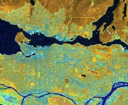
- Spatial Analysis and Satellite Imagery in a GIS: University of Toronto
- Geographical Information Systems - Part 1: École Polytechnique Fédérale de Lausanne
- Spatial Data Science and Applications: Yonsei University
- Mastering Geospatial Analysis with QGIS: L&T EduTech
- ChatGPT + Excel: Master AI-driven Formulas & Visualizations: Vanderbilt University
- AutoCAD 2023 Masterclass - Produce Amazing Site Plans: Packt
- GIS Data Formats, Design and Quality: University of California, Davis
- Product Development using AutoCAD: Coursera Project Network
- How to Create Realistic Reflections with Adobe Photoshop: Coursera Project Network
- Using Data for Geographic Mapping and Forecasting in SAS Visual Analytics: SAS


