Geospatial Courses
Geospatial courses can help you learn geographic information systems (GIS), remote sensing, spatial analysis, and cartography. You can build skills in data visualization, location-based analysis, and interpreting spatial data. Many courses introduce tools like ArcGIS, QGIS, and Google Earth, that support mapping and analyzing geographic data. You may also explore applied areas such as urban planning, environmental monitoring, and disaster management, providing practical insights into how geospatial techniques impact various industries.
Popular Geospatial Courses and Certifications
 Status: Free
Skills you'll gain: ArcGIS, Data Presentation, GIS Software, Spatial Data Analysis, Data Visualization, Geographic Information Systems, Geospatial Information and Technology, Geospatial Mapping, Data Import/Export, Data Mapping, Data Integration, Data Management
Skills you'll gain: Google Analytics, Ad Hoc Reporting, Marketing Analytics, Email Automation, Data-Driven Decision-Making, Web Analytics, Dashboard, Geospatial Information and Technology, Marketing, Data Analysis, Data Visualization
 Status: Free Trial
Skills you'll gain: Interactive Data Visualization, Exploratory Data Analysis, Dashboard, Data Visualization Software, Data Integration, Heat Maps, Spatial Data Analysis, Data-Driven Decision-Making, Decision Support Systems, Business Intelligence Software, Geospatial Information and Technology, Data Mapping
 Status: Preview
Institut Mines-Télécom
Skills you'll gain: Augmented Reality, Augmented and Virtual Reality (AR/VR), Mobile Development, Android (Operating System), Image Analysis, 3D Assets, Geospatial Information and Technology, Computer Vision, Global Positioning Systems, Prototyping, User Interface (UI)
 Status: Free Trial
University of Colorado Boulder
Skills you'll gain: Environment, Environmental Monitoring, Physical Science, Hydrology, Environmental Science, Climate Change Adaptation, Geospatial Information and Technology, Geographic Information Systems, Social Studies, World History
 Status: Free Trial
University of California, Irvine
Skills you'll gain: Predictive Modeling, Natural Language Processing, Social Media, Text Mining, Cloud Computing, Unstructured Data, Big Data, Business Analytics, Data Science, Data Analysis, Geospatial Information and Technology, Internet Of Things, Deep Learning
 Status: New
Skills you'll gain: Threat Detection, Cyber Security Strategy, Cyber Threat Intelligence, Cybersecurity, Interactive Data Visualization, Geospatial Information and Technology, Web Scraping, Digital Forensics, IT Automation, Data Security, Security Awareness, Personally Identifiable Information, Network Security, Scripting, Network Analysis, Open Source Technology, Data Analysis Software, Information Privacy
 Status: Free Trial
Johns Hopkins University
Skills you'll gain: Data Visualization Software, Scientific Visualization, Interactive Data Visualization, Geospatial Information and Technology, Data Presentation, Color Theory, Graphic and Visual Design, Data Visualization, Tree Maps, Visualization (Computer Graphics), Data Storytelling, Design Elements And Principles, Plot (Graphics), Data Literacy, Heat Maps, Computer Displays, Exploratory Data Analysis, Time Series Analysis and Forecasting, Data Mapping, Display Devices
 Status: Preview
Universitat de Barcelona
Skills you'll gain: Water Resources, Global Positioning Systems, Environmental Monitoring, Water Quality, Physical Science, Geospatial Information and Technology, Chemistry, Environment, Environmental Science, Climate Change Adaptation, Remote Access Systems
 Status: Free Trial
Microsoft
Skills you'll gain: Rmarkdown, Version Control, Web Scraping, Regression Analysis, Knitr, Exploratory Data Analysis, Statistical Analysis, Data Manipulation, Dimensionality Reduction, Ggplot2, Geospatial Information and Technology, Time Series Analysis and Forecasting, Plotly, Microsoft Azure, Data Cleansing, Data Visualization, Software Documentation, R Programming, Data Quality, Microsoft Copilot
 Status: NewStatus: Preview
AI CERTs
Skills you'll gain: Model Evaluation, Digital Transformation, Geospatial Information and Technology, Environmental Regulations, Predictive Modeling, Advanced Analytics, Environment and Resource Management, Computer Vision, Environment Health And Safety, Environment, Supervised Learning, Operations, Workforce Development, Operations Management
 Status: Preview
Board Infinity
Skills you'll gain: Data Visualization Software, Dashboard, Data Visualization, Interactive Data Visualization, Data Transformation, Tableau Software, Data Storytelling, Data Manipulation, Exploratory Data Analysis, Heat Maps, Scatter Plots, Data Analysis, Forecasting, Geospatial Mapping
In summary, here are 10 of our most popular geospatial courses
- ArcGIS for Beginners: Mapping Urban Green Spaces: Coursera
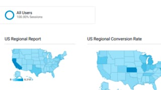
- Building Custom Regional Reports with Google Analytics: Coursera
- Dashboards in Qlik Sense: Decision-Support Dashboards: Coursera
- Getting started with Augmented Reality: Institut Mines-Télécom
- Intro to the Arctic: University of Colorado Boulder
- Natural Language Processing and Capstone Assignment: University of California, Irvine
- The OSINT Handbook: Mastering Open Source Intelligence: Packt
- Data Visualization: Johns Hopkins University
- Oceanografía: una clave para entender mejor nuestro mundo: Universitat de Barcelona
- Microsoft R Programming for Everyone: Microsoft


