Geospatial Courses
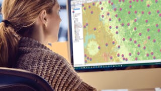
Geospatial courses can help you learn geographic information systems (GIS), remote sensing, spatial analysis, and cartography. You can build skills in data visualization, location-based analysis, and interpreting spatial data. Many courses introduce tools like ArcGIS, QGIS, and Google Earth, that support mapping and analyzing geographic data. You may also explore applied areas such as urban planning, environmental monitoring, and disaster management, providing practical insights into how geospatial techniques impact various industries.
Popular Geospatial Courses and Certifications
 Status: Free Trial
University of California, Davis
Skills you'll gain: ArcGIS, GIS Software, Spatial Analysis, Data Storytelling, Spatial Data Analysis, Geographic Information Systems, Data Presentation, Geospatial Information and Technology, Geospatial Mapping, Public Health and Disease Prevention, Data Sharing, Public Health, Land Management, Heat Maps, Epidemiology, Community Health, Image Analysis, Project Management, Data Visualization Software, Data Quality
 Status: Free Trial
L&T EduTech
Skills you'll gain: Geospatial Information and Technology, Spatial Analysis, GIS Software, Spatial Data Analysis, Geographic Information Systems, Geospatial Mapping, Construction Engineering, Database Management, Construction, Construction Management, Architecture and Construction, Global Positioning Systems, Visualization (Computer Graphics), Civil and Architectural Engineering, Decision Support Systems, Building Information Modeling, Survey Creation, AutoCAD Civil 3D, Data Manipulation, Network Analysis
 Status: Free Trial
Case Western Reserve University
Skills you'll gain: Exploratory Data Analysis, Spatial Data Analysis, Spatial Analysis, Geospatial Mapping, Geospatial Information and Technology, Descriptive Statistics, Statistical Modeling, R Programming, Geographic Information Systems, Statistical Analysis, Probability & Statistics, Data-Driven Decision-Making, Oil and Gas, Data Analysis, Simulations, Statistical Methods, Rmarkdown, Data Cleansing, Box Plots, Plot (Graphics)
 Status: Free Trial
L&T EduTech
Skills you'll gain: Spatial Analysis, GIS Software, Spatial Data Analysis, Geospatial Mapping, Geographic Information Systems, Building Information Modeling, Data Manipulation, Global Positioning Systems, Network Analysis, Image Analysis, Data Import/Export, Unsupervised Learning, Software Installation, Supervised Learning, UI Components
 Status: Free Trial
University of California, Davis
Skills you'll gain: ArcGIS, Data Storytelling, Spatial Data Analysis, Data Presentation, Geographic Information Systems, Spatial Analysis, Geospatial Mapping, Heat Maps, Data Visualization Software, Network Analysis, Data Manipulation
 Status: Free Trial
Case Western Reserve University
Skills you'll gain: Geostatistics, Exploratory Data Analysis, Spatial Data Analysis, Spatial Analysis, Geospatial Mapping, Geospatial Information and Technology, Statistical Modeling, R Programming, Statistical Analysis, Probability & Statistics, Data Analysis, Data-Driven Decision-Making, Regression Analysis, Correlation Analysis, Data Validation, Histogram, Box Plots, Simulation and Simulation Software, Model Evaluation
What brings you to Coursera today?
 Status: Free Trial
University of Toronto
Skills you'll gain: ArcGIS, Spatial Data Analysis, Spatial Analysis, Geographic Information Systems, Geospatial Mapping, GIS Software, Data Mapping, Geospatial Information and Technology, Data Visualization, Metadata Management, Query Languages, Global Positioning Systems, Quantitative Research, Data Compilation, Typography, Data Manipulation, Data Storytelling, Data Modeling, Design Elements And Principles, Image Analysis
 Status: NewStatus: Free Trial
University of Pittsburgh
Skills you'll gain: Data Storytelling, Interactive Data Visualization, Data Visualization Software, Data Presentation, Data Visualization, Tableau Software, Matplotlib, Geospatial Information and Technology, Spatial Analysis, Geospatial Mapping, Visualization (Computer Graphics), Seaborn, Infographics, Heat Maps, Data Ethics, Text Mining, Data Mapping, Network Analysis
 Status: Free Trial
Case Western Reserve University
Skills you'll gain: Geostatistics, Exploratory Data Analysis, Spatial Analysis, Descriptive Statistics, Box Plots, Statistical Modeling, Geospatial Information and Technology, R Programming, Plot (Graphics), Rmarkdown, Data Analysis, Data Cleansing, Statistical Methods, Simulations
 Status: Free Trial
L&T EduTech
Skills you'll gain: Construction Engineering, Geospatial Mapping, Geospatial Information and Technology, Geographic Information Systems, Spatial Data Analysis, Construction, Construction Management, Architecture and Construction, Visualization (Computer Graphics), Civil and Architectural Engineering, Spatial Analysis, Global Positioning Systems, Survey Creation, AutoCAD Civil 3D, 3D Modeling
 Status: Free Trial
Johns Hopkins University
Skills you'll gain: Rmarkdown, Shiny (R Package), Ggplot2, Tidyverse (R Package), Data Visualization, Spatial Data Analysis, Statistical Visualization, Scatter Plots, Plot (Graphics), Dashboard, Data Import/Export, Interactive Data Visualization, R Programming, Data Visualization Software, Geospatial Information and Technology, Data Literacy, Statistical Reporting, Storyboarding, Data Science, Data Analysis
 Status: Free Trial
Skills you'll gain: Data Storytelling, Data Presentation, Plotly, Data Visualization Software, Data Visualization, Dashboard, Interactive Data Visualization, Matplotlib, Geospatial Information and Technology, Histogram, Seaborn, Data Analysis, Scatter Plots, Jupyter, Geospatial Mapping, Python Programming
In summary, here are 10 of our most popular geospatial courses
- Geographic Information Systems (GIS): University of California, Davis
- Geospatial Techniques for Engineers: L&T EduTech
- Practical Geospatial Geostatistical Modeling: Case Western Reserve University
- Mastering Geospatial Analysis with QGIS: L&T EduTech
- Geospatial Analysis with ArcGIS : University of California, Davis
- Basic Principles of Geostatistical Geospatial Modeling: Case Western Reserve University
- GIS, Mapping, and Spatial Analysis: University of Toronto
- Interactive, Geospatial & Narrative Data Visualization: University of Pittsburgh
- Using R for Geostatistical Geospatial Modeling : Case Western Reserve University
- Geospatial Technology for Construction : L&T EduTech


