QGIS Courses
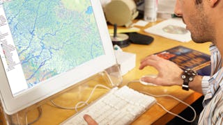
QGIS courses can help you learn geographic information systems, spatial analysis, data visualization, and cartography techniques. You can build skills in managing geographic data, creating detailed maps, and analyzing spatial relationships. Many courses introduce tools like QGIS software, which allows you to manipulate and visualize geospatial data effectively, along with methods for conducting field surveys and integrating various data sources.
Popular QGIS Courses and Certifications
 Status: Free Trial
L&T EduTech
Skills you'll gain: Spatial Analysis, GIS Software, Spatial Data Analysis, Geospatial Mapping, Geographic Information Systems, Building Information Modeling, Data Manipulation, Global Positioning Systems, Network Analysis, Image Analysis, Data Import/Export, Unsupervised Learning, Software Installation, Supervised Learning, UI Components
 Status: Free Trial
University of California, Davis
Skills you'll gain: ArcGIS, GIS Software, Geographic Information Systems, Data Sharing, Spatial Analysis, Metadata Management, Data Quality, Data Visualization, Data Visualization Software, Data Analysis, File Management
 Status: NewStatus: Free Trial
Skills you'll gain: Interactive Data Visualization, Data Storytelling, Data Visualization, Dashboard, Business Intelligence, Business Intelligence Software, Data Visualization Software, Data-Driven Decision-Making, Customer Analysis, Data Modeling, Data Analysis, Data Integration, Advanced Analytics, Spatial Data Analysis, Exploratory Data Analysis, Statistical Analysis, Data Transformation, Decision Support Systems, Collaborative Software, Data Validation
 Status: Free Trial
University of Toronto
Skills you'll gain: ArcGIS, Spatial Data Analysis, Spatial Analysis, Geographic Information Systems, Geospatial Mapping, GIS Software, Data Mapping, Geospatial Information and Technology, Data Visualization, Metadata Management, Query Languages, Global Positioning Systems, Quantitative Research, Data Compilation, Typography, Data Manipulation, Data Storytelling, Data Modeling, Design Elements And Principles, Image Analysis
 Status: Free Trial
University of California, Davis
Skills you'll gain: ArcGIS, GIS Software, Spatial Analysis, Data Storytelling, Spatial Data Analysis, Geographic Information Systems, Data Presentation, Geospatial Information and Technology, Geospatial Mapping, Public Health and Disease Prevention, Data Sharing, Public Health, Land Management, Heat Maps, Epidemiology, Community Health, Image Analysis, Project Management, Data Visualization Software, Data Quality
 Status: Free Trial
University of Toronto
Skills you'll gain: ArcGIS, Spatial Data Analysis, Geographic Information Systems, Spatial Analysis, Geospatial Mapping, Data Mapping, Global Positioning Systems, Data Capture
What brings you to Coursera today?
 Status: Free Trial
University of Michigan
Skills you'll gain: Sustainable Development, Geographic Information Systems, Geospatial Mapping, Sustainability Reporting, Spatial Data Analysis, Sustainable Business, Spatial Analysis, Data Storytelling, Environmental Monitoring, Data Visualization, Stakeholder Engagement, Trend Analysis, Decision Making
 Status: Free Trial
University of Toronto
Skills you'll gain: Geographic Information Systems, GIS Software, Spatial Analysis, Spatial Data Analysis, Geospatial Information and Technology, Geospatial Mapping, Query Languages, Data Manipulation, Image Analysis
 Status: Free Trial
L&T EduTech
Skills you'll gain: Geospatial Information and Technology, Spatial Analysis, GIS Software, Spatial Data Analysis, Geographic Information Systems, Geospatial Mapping, Construction Engineering, Database Management, Construction, Construction Management, Architecture and Construction, Global Positioning Systems, Visualization (Computer Graphics), Civil and Architectural Engineering, Decision Support Systems, Building Information Modeling, Survey Creation, AutoCAD Civil 3D, Data Manipulation, Network Analysis
 Status: Preview
Skills you'll gain: Geographic Information Systems, Geospatial Mapping, Spatial Data Analysis, Spatial Analysis, Global Positioning Systems, Data Analysis, Metadata Management, Decision Support Systems
 Status: Free Trial
Case Western Reserve University
Skills you'll gain: Exploratory Data Analysis, Spatial Data Analysis, Spatial Analysis, Geospatial Mapping, Geospatial Information and Technology, Descriptive Statistics, Statistical Modeling, R Programming, Geographic Information Systems, Statistical Analysis, Probability & Statistics, Data-Driven Decision-Making, Oil and Gas, Data Analysis, Simulations, Statistical Methods, Rmarkdown, Data Cleansing, Box Plots, Plot (Graphics)
 Status: Free Trial
University of California, Davis
Skills you'll gain: ArcGIS, Data Storytelling, Spatial Data Analysis, Data Presentation, Geographic Information Systems, Spatial Analysis, Geospatial Mapping, Heat Maps, Data Visualization Software, Network Analysis, Data Manipulation
In summary, here are 10 of our most popular qgis courses
- Mastering Geospatial Analysis with QGIS: L&T EduTech
- Fundamentals of GIS: University of California, Davis
- Qlik Sense for Business Intelligence: Coursera
- GIS, Mapping, and Spatial Analysis: University of Toronto
- Geographic Information Systems (GIS): University of California, Davis
- Introduction to GIS Mapping: University of Toronto
- GIS: Geographic Information Systems for Sustainability: University of Michigan
- Spatial Analysis and Satellite Imagery in a GIS: University of Toronto
- Geospatial Techniques for Engineers: L&T EduTech
- GIS Mastery: Spatial Data, Remote Sensing, Decision Support: Coursera


