
Ce cours est la deuxième partie d'une formation dédiée aux bases théoriques et pratiques des Systèmes d'Information Géographique (SIG). Il propose une introduction aux SIG qui ne nécessite pas de compétences informatiques préalables. Il permet d'acquérir rapidement les bases permettant de créer des bases de données spatiales et de produire des cartes géographiques. C'est un cours pratique qui s'appuie sur l'utilisation de logiciels Open source gratuits (QGIS, Geoda). Dans la première partie du cours (Systèmes d'information géographique - Partie 1), vous avez exploré les bases de la numérisation des terrains et du stockage des géodonnées. Vous avez notamment appris à : - Caractériser les objets et phénomènes spatiaux (modélisation spatiale) du point de vue de leur positionnement dans l'espace (systèmes de coordonnées et projections, relations spatiales) et selon leur nature intrinsèque (mode objet ou vecteur vs mode image ou raster) ; - Utiliser différentes méthodes d'acquisition de données (mesure directe, géoréférencement d'images, numérisation, source de données existante, etc.) ; - Utiliser différents modes de stockage des géodonnées (fichiers simples et bases de données relationnelles) ; - Utiliser les outils de modélisation des données pour décrire et mettre en œuvre une base de données ; - Créer des requêtes dans un langage de requête et de manipulation des données. La deuxième partie du cours traite des méthodes d'analyse spatiale et des techniques de représentation de l'information géoréférencée. Vous apprendrez notamment à : - Analyser les propriétés spatiales de variables discrètes, par exemple en quantifiant l'autocorrélation spatiale ; - Travailler avec des variables continues (Échantillonnage, interpolation et construction d'isolignes) ; - Utiliser des modèles numériques d'élévation (MNE) et leurs dérivés (pente, orientation, etc.) ; - Utiliser les techniques de superposition de géodonnées ; - Produire des documents cartographiques selon les règles de la sémiologie graphique ; - Explorer d'autres formes de représentation spatiale (cartographie interactive sur internet, représentations 3D et réalité augmentée). La page https://www.facebook.com/moocsig constitue un forum interactif pour les participants à ce cours.
Systèmes d'information géographique - Partie 2
Systèmes d'information géographique - Partie 2


Instructeurs : Marc Soutter
1 794 déjà inscrits
Inclus avec
Expérience recommandée
Compétences que vous acquerrez
- Catégorie : Géostatistique
- Catégorie : Visualisation interactive des données
- Catégorie : Systèmes d'information géographique
- Catégorie : Réalité augmentée
- Catégorie : Analyse des données spatiales
- Catégorie : Cartographie géospatiale
- Catégorie : Cartographie des données
- Catégorie : Échantillonnage (statistiques)
- Catégorie : Intégration de données
- Catégorie : Logiciel SIG
- Catégorie : Analyse spatiale
- Section Compétences masquée. Affichage de 7 compétence(s) sur 11.
Détails à connaître

Ajouter à votre profil LinkedIn
11 devoirs
Découvrez comment les employés des entreprises prestigieuses maîtrisent des compétences recherchées

Il y a 6 modules dans ce cours
Les objets de l'espace géographique sont modélisés comme des phénomènes spatiaux discontinus dont les propriétés sont définies en fonction des dimensions géométrique, thématique et spatiale : géométrique. Les propriétés de ces objets spatiaux peuvent être décrites par différents indices qui caractérisent la forme, la taille, la distribution spatiale ou encore la dépendance spatiale d'un objet. Considérés simultanément, en lien avec le contexte de l'étude, ces indices décrivent le paysage étudié.
Inclus
6 vidéos2 devoirs
Un phénomène est considéré comme spatialement continu s'il est défini en tout point de l'espace géographique et si ses propriétés varient localement de manière graduelle et structurée. L'altitude, l'humidité du sol, la concentration en métaux lourds et autres contaminants du sol sont des exemples courants de phénomènes spatiaux continus. Ce module commencera par aborder les différentes méthodes d'échantillonnage, puis les méthodes d'interpolation déterministes qui ne nécessitent aucune étude a priori du phénomène. Nous introduirons ensuite la géostatistique, qui est basée sur la notion de fonctions aléatoires, et nous terminerons en abordant les concepts et l'application des variables régionalisées, de l'analyse des variogrammes et du krigeage.
Inclus
5 vidéos1 devoir
Le relief topographique joue un rôle à la fois révélateur et explicatif de la manière dont les phénomènes se déroulent à la surface de la Terre. Il constitue un élément important dans la détermination des modes d'occupation humaine et contrôle également les conditions environnementales qui favorisent, ou au contraire entravent, l'établissement et le développement de différentes colonies végétales et animales. En conséquence, le relief occupe une position centrale dans l'analyse spatiale et est important pour toute discipline qui s'intéresse à l'activité humaine ou aux phénomènes naturels. Ce chapitre présentera un bref aperçu des différentes méthodes utilisées pour acquérir des données d'élévation et couvrira également les algorithmes, et leurs propriétés, qui sont utilisés pour dériver d'importants indicateurs descriptifs du relief.
Inclus
3 vidéos2 devoirs
Grâce à la superposition spatiale, les SIG peuvent être utilisés pour combiner des données provenant de différentes sources ou de différents formats (matriciel ou vectoriel) en transférant des informations entre les couches en fonction de leurs relations spatiales. Souvent, l'analyse de phénomènes géographiquement distribués nécessite la prise en compte simultanée de données provenant de différentes sources. Cela est possible grâce à la superposition spatiale, qui est la fonctionnalité déterminante et le principal avantage des systèmes d'information géographique.
Inclus
4 vidéos2 devoirs
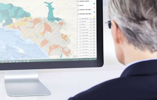
Cette semaine, vous apprendrez à appliquer les règles établies de la cartographie thématique afin de présenter efficacement l'information géographique. Vous apprendrez à traiter des informations quantitatives ou qualitatives, et nous vous montrerons comment utiliser le QGIS Print Composer pour créer vos propres cartes thématiques. Les cartes thématiques doivent être créées en tenant compte d'un certain nombre de contraintes. Ces règles - par exemple, choisir des palettes de couleurs qui respectent la sémiologie des graphiques, veiller à ce que votre carte comprenne un certain nombre de composants essentiels tels qu'une légende, une échelle, des sources de données et une description - garantissent un transfert de données efficace et une interprétation performante.
Inclus
4 vidéos1 devoir
Au cours de cette dernière semaine de cours, nous nous concentrerons sur les méthodes alternatives de représentation de l'information géographique, en particulier à travers la cartographie dynamique basée sur le web, les représentations tridimensionnelles et, enfin, nous verrons comment la réalité augmentée peut être incorporée dans les systèmes d'information géographique.
Inclus
3 vidéos3 devoirs
Instructeurs
Offert par
En savoir plus sur Sciences de l'environnement et durabilité
 Statut : Prévisualisation
École Polytechnique Fédérale de Lausanne
 Statut : Essai gratuit
University of California, Davis
 Statut : Prévisualisation
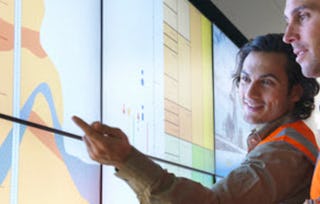 Statut : Essai gratuit
University of California, Davis
Pour quelles raisons les étudiants sur Coursera nous choisissent-ils pour leur carrière ?

Felipe M.

Jennifer J.

Larry W.

Chaitanya A.

Ouvrez de nouvelles portes avec Coursera Plus
Accès illimité à 10,000+ cours de niveau international, projets pratiques et programmes de certification prêts à l'emploi - tous inclus dans votre abonnement.
Faites progresser votre carrière avec un diplôme en ligne
Obtenez un diplôme auprès d’universités de renommée mondiale - 100 % en ligne
Rejoignez plus de 3 400 entreprises mondiales qui ont choisi Coursera pour les affaires
Améliorez les compétences de vos employés pour exceller dans l’économie numérique
Foire Aux Questions
Pour accéder aux supports de cours, aux devoirs et pour obtenir un certificat, vous devez acheter l'expérience de certificat lorsque vous vous inscrivez à un cours. Vous pouvez essayer un essai gratuit ou demander une aide financière. Le cours peut proposer l'option "Cours complet, pas de certificat". Cette option vous permet de consulter tous les supports de cours, de soumettre les évaluations requises et d'obtenir une note finale. Cela signifie également que vous ne pourrez pas acheter un certificat d'expérience.
Lorsque vous achetez un certificat, vous avez accès à tous les supports de cours, y compris les devoirs notés. Une fois le cours terminé, votre certificat électronique sera ajouté à votre page de réalisations - à partir de là, vous pouvez imprimer votre certificat ou l'ajouter à votre profil LinkedIn.
Oui, pour certains programmes de formation, vous pouvez demander une aide financière ou une bourse si vous n'avez pas les moyens de payer les frais d'inscription. Si une aide financière ou une bourse est disponible pour votre programme de formation, vous trouverez un lien de demande sur la page de description.
Plus de questions
Aide financière disponible,