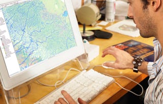
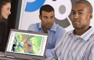
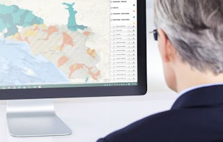
Appliquez vos connaissances en SIG dans ce cours sur l'analyse géospatiale, en vous concentrant sur les outils d'analyse, les données 3D, le travail avec les rasters, les projections et les variables d'environnement. Tout au long des quatre semaines de ce cours, nous travaillerons ensemble sur un projet - ce qui est unique à ce cours - depuis la conception du projet, en passant par la récupération des données, la gestion et le traitement des données initiales, et enfin nos produits d'analyse. Dans ce cours, vous apprendrez les principes fondamentaux de l'analyse géospatiale et environnementale au cours de quatre modules d'une semaine : Semaine 1 : Comment représenter les données spatiales et analyser les relations spatiales à l'aide d'ArcGIS Pro Semaine 2 : Mener une analyse basée sur les réseaux Semaine 3 : Démonstration des cartes thermiques et de l'analyse des points chauds dans ArcGIS Pro Semaine 4 : Développez vos connaissances en matière de narration de données. Apprenez à afficher visuellement vos données et à partager vos cartes dans ArcGIS Online. Suivez le cours Geospatial Analysis with ArcGIS en tant que cours autonome ou dans le cadre de la spécialisation en systèmes d'information géographique (SIG). Avant de suivre ce cours, vous devez avoir une expérience équivalente à celle acquise dans les premier et deuxième cours de cette spécialisation, à savoir "Fundamentals of GIS" et "GIS Data Formats, Design, and Quality". En suivant ce troisième cours de la Specializations, vous acquerrez les compétences nécessaires pour réussir dans le programme complet.
Analyse géospatiale avec ArcGIS
Analyse géospatiale avec ArcGIS
Ce cours fait partie de Spécialisation "Systèmes d'information géographique (SIG)"

Instructeur : Eric Howard
8 648 déjà inscrits
Inclus avec
130 avis
Expérience recommandée
Compétences que vous acquerrez
- Catégorie : Information et technologie géospatiales
- Catégorie : Routage de réseau
- Catégorie : Cartographie géospatiale
- Catégorie : Logiciel de visualisation de données
- Catégorie : Récit de données
- Catégorie : Analyse des données spatiales
- Catégorie : Manipulation de données
- Catégorie : ArcGIS
- Catégorie : Analyse spatiale
- Catégorie : Présentation des données
- Catégorie : Logiciel SIG
- Catégorie : Analyse du réseau
Outils que vous découvrirez
- Catégorie : Cartes de chaleur
- Catégorie : Systèmes d'information géographique
Détails à connaître

Ajouter à votre profil LinkedIn
4 devoirs
Découvrez comment les employés des entreprises prestigieuses maîtrisent des compétences recherchées

Élaborez votre expertise du sujet
- Apprenez de nouveaux concepts auprès d'experts du secteur
- Acquérez une compréhension de base d'un sujet ou d'un outil
- Développez des compétences professionnelles avec des projets pratiques
- Obtenez un certificat professionnel partageable

Il y a 4 modules dans ce cours
Obtenez un certificat professionnel
Ajoutez ce titre à votre profil LinkedIn, à votre curriculum vitae ou à votre CV. Partagez-le sur les médias sociaux et dans votre évaluation des performances.
Instructeur
Offert par
En savoir plus sur Analyse des données
University of California, Davis
University of California, Davis
University of California, Davis
Pour quelles raisons les étudiants sur Coursera nous choisissent-ils pour leur carrière ?

Felipe M.

Jennifer J.

Larry W.

Chaitanya A.
Avis des étudiants
- 5 stars
72,30 %
- 4 stars
13,07 %
- 3 stars
10 %
- 2 stars
0,76 %
- 1 star
3,84 %
Affichage de 3 sur 130
Révisé le 21 janv. 2024
Great course! I like the explanations and demostrations using ArcGIS Pro
Révisé le 8 mars 2024
Fun but practical assignments showing how to use vital tools in ArcGIS Pro
Révisé le 30 oct. 2024
Great overview of Spatial Analysis tools and publishing/sharing possibilities

Ouvrez de nouvelles portes avec Coursera Plus
Accès illimité à 10,000+ cours de niveau international, projets pratiques et programmes de certification prêts à l'emploi - tous inclus dans votre abonnement.
Faites progresser votre carrière avec un diplôme en ligne
Obtenez un diplôme auprès d’universités de renommée mondiale - 100 % en ligne
Rejoignez plus de 3 400 entreprises mondiales qui ont choisi Coursera pour les affaires
Améliorez les compétences de vos employés pour exceller dans l’économie numérique
Foire Aux Questions
Plus de questions
Aide financière disponible,